Problem:
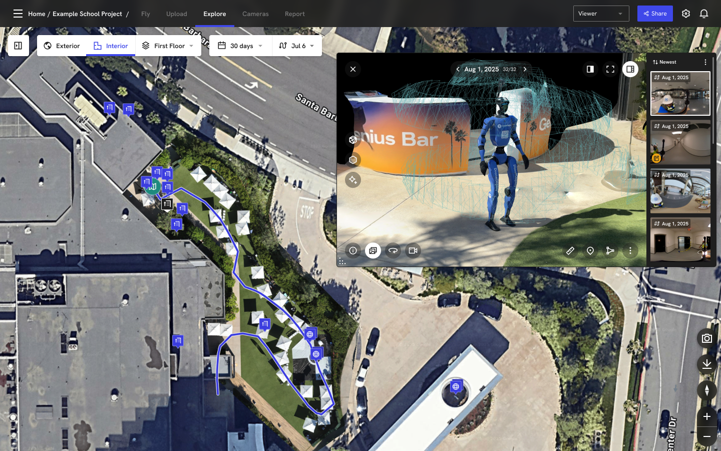
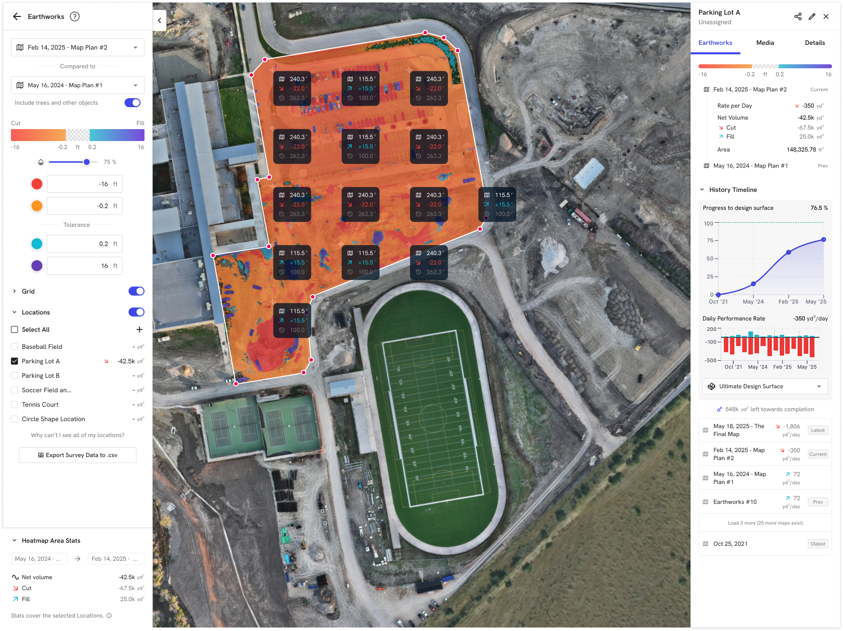
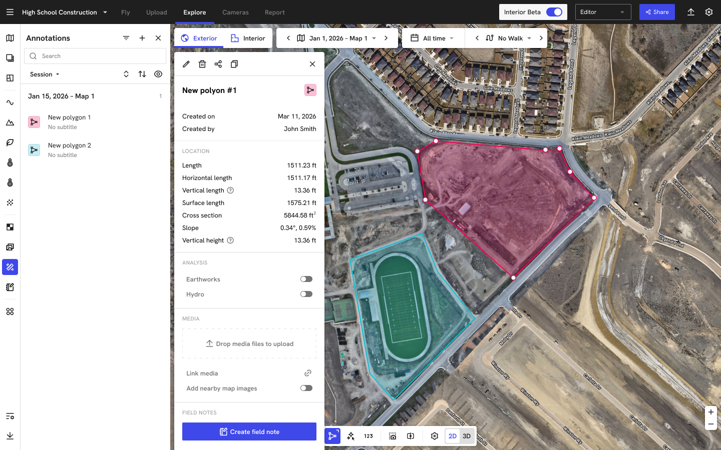
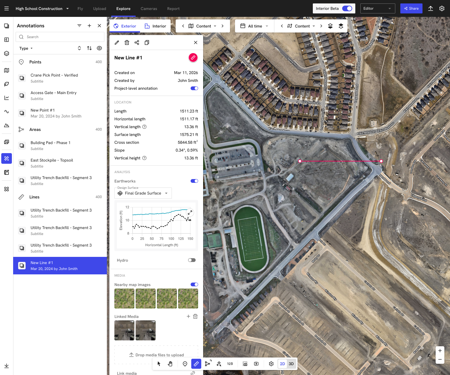
On DroneDeploy's explore page, markups (annotations, locations, and measurements) had grown into separate systems with different data models, tools, and UI patterns. This created fragmentation for customers: the same site could have shapes and notes scattered across multiple lists, inconsistent behaviors between 2D and 3D, and duplicated tools for areas, volumes, and locations. It also created technical drag — each markup type required its own plumbing, migration logic, and performance tuning, which slowed our ability to ship improvements across the platform.
Solution:
I led the early product design work to unify markups into a single, flexible system. At the UX level, this meant defining a common interaction model: one selection model across map, model, and list; a single, modular detail panel where users can toggle on capabilities like analysis, media grouping, and field notes; and a consolidated toolbar that treats "draw a shape" as one entry point rather than multiple parallel tools. At the systems level, I partnered with engineering to move toward a shared locations-based data model, so all shapes are stored and rendered consistently. The result is a simpler mental model for users (one markup system instead of many) and a more scalable foundation for the team to layer on new capabilities like advanced measurements and unified 2D/3D experiences.
⚠️ Case study is available upon request. ⚠️